


1630082 - LOUISVILLE Voting District, Jefferson County, Georgia
About
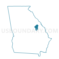
Outline

Summary
| Unique Area Identifier | 562293 |
| Name | 1630082 - LOUISVILLE Voting District |
| County | Jefferson County |
| State | Georgia |
| Area (square miles) | 209.45 |
| Land Area (square miles) | 207.45 |
| Water Area (square miles) | 2.00 |
| % of Land Area | 99.04 |
| % of Water Area | 0.96 |
| Latitude of the Internal Point | 33.02428770 |
| Longtitude of the Internal Point | -82.42013340 |
Maps


Graphs
Select a template below for downloading or customizing gragh for 1630082 - LOUISVILLE Voting District, Jefferson County, Georgia


Neighbors
Neighoring Voting District (by Name) Neighboring Voting District on the Map
- 0330004 - GOUGH Voting District, Burke County, GA
- 0330007 - MIDVILLE Voting District, Burke County, GA
- 0330013 - VIDETTE Voting District, Burke County, GA
- 1070052 - CROSS-GREEN Voting District, Emanuel County, GA
- 125EDGH - EDGEHILL Voting District, Glascock County, GA
- 1630076 - STAPLETON CROSSING Voting District, Jefferson County, GA
- 1630077 - MATTHEWS Voting District, Jefferson County, GA
- 1630081 - WRENS Voting District, Jefferson County, GA
- 1630083 - WADLEY Voting District, Jefferson County, GA
- 1630085 - BARTOW Voting District, Jefferson County, GA
- 1631593 - AVERA Voting District, Jefferson County, GA
- 3031350 - WARTHEN Voting District, Washington County, GA
- 30394 - DAVISBORO Voting District, Washington County, GA
Top 10 Neighboring County Subdivision (by Population) Neighboring County Subdivision on the Map
- Louisville CCD, Jefferson County, GA (6,096)
- Wrens CCD, Jefferson County, GA (5,179)
- Davisboro CCD, Washington County, GA (3,844)
- Wadley CCD, Jefferson County, GA (3,552)
- Stapleton CCD, Jefferson County, GA (2,103)
- Summertown CCD, Emanuel County, GA (1,742)
- Warthen CCD, Washington County, GA (941)
- Midville CCD, Burke County, GA (922)
- Mitchell CCD, Glascock County, GA (874)
- Vidette CCD, Burke County, GA (835)
Top 10 Neighboring Place (by Population) Neighboring Place on the Map
Top 10 Neighboring Unified School District (by Population) Neighboring Unified School District on the Map
- Burke County School District, GA (23,316)
- Emanuel County School District, GA (22,598)
- Washington County School District, GA (21,187)
- Jefferson County School District, GA (16,930)
- Glascock County School District, GA (3,082)
Top 10 Neighboring State Legislative District Lower Chamber (by Population) Neighboring State Legislative District Lower Chamber on the Map
- State House District 123, GA (49,250)
- State House District 124, GA (45,898)
- State House District 142, GA (45,637)
Top 10 Neighboring State Legislative District Upper Chamber (by Population) Neighboring State Legislative District Upper Chamber on the Map
Top 10 Neighboring 111th Congressional District (by Population) Neighboring 111th Congressional District on the Map
Top 10 Neighboring Census Tract (by Population) Neighboring Census Tract on the Map
- Census Tract 9603, Jefferson County, GA (6,096)
- Census Tract 9505, Washington County, GA (5,499)
- Census Tract 9601, Jefferson County, GA (5,179)
- Census Tract 9604, Jefferson County, GA (3,552)
- Census Tract 101, Glascock County, GA (3,082)
- Census Tract 9602, Jefferson County, GA (2,103)
- Census Tract 9501, Washington County, GA (1,832)
- Census Tract 9509, Burke County, GA (1,757)
- Census Tract 9702, Emanuel County, GA (1,742)
Top 10 Neighboring 5-Digit ZIP Code Tabulation Area (by Population) Neighboring 5-Digit ZIP Code Tabulation Area on the Map
- 30434, GA (5,728)
- 30833, GA (4,043)
- 30477, GA (3,070)
- 31018, GA (2,837)
- 30810, GA (2,138)
- 30816, GA (2,109)
- 30823, GA (1,800)
- 30441, GA (1,663)
- 30413, GA (1,575)
- 31094, GA (1,114)